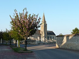
Lasson, Calvados
Appearance
You can help expand this article with text translated from the corresponding article in French. (December 2008) Click [show] for important translation instructions.
|
Lasson | |
|---|---|
Part of Rots | |
 Saint-Pierre | |
| Coordinates: 49°14′04″N 0°27′45″W / 49.2344°N 0.4625°W | |
| Country | France |
| Region | Normandy |
| Department | Calvados |
| Arrondissement | Caen |
| Canton | Thue et Mue |
| Commune | Rots |
Area 1 | 4.02 km2 (1.55 sq mi) |
| Population (2022)[1] | 661 |
| • Density | 160/km2 (430/sq mi) |
| Time zone | UTC+01:00 (CET) |
| • Summer (DST) | UTC+02:00 (CEST) |
| Postal code | 14740 |
| Elevation | 34–59 m (112–194 ft) (avg. 30 m or 98 ft) |
| 1 French Land Register data, which excludes lakes, ponds, glaciers > 1 km2 (0.386 sq mi or 247 acres) and river estuaries. | |
Lasson (French pronunciation: [lasɔ̃] ⓘ) is a former commune in the Calvados department in the Normandy region in northwestern France. On 1 January 2016, it was merged into the commune of Rots.[2]
Population
[edit]| Year | Pop. | ±% |
|---|---|---|
| 1962 | 211 | — |
| 1968 | 228 | +8.1% |
| 1975 | 256 | +12.3% |
| 1982 | 331 | +29.3% |
| 1990 | 382 | +15.4% |
| 1999 | 494 | +29.3% |
| 2008 | 585 | +18.4% |
See also
[edit]References
[edit]- ^ "Populations de référence 2022" [Reference populations 2022] (PDF) (in French). INSEE. December 2024.
- ^ Arrêté préfectoral 22 December 2015 (in French)
External links
[edit]Wikimedia Commons has media related to Lasson (Calvados).


